
Tracing a Passaic Street
A workable Passaic street directory search starts with the address as written, then checks its current postal form and city municipality. USPS helps standardize the delivery address. County GIS helps tie that street point to a parcel. The City-linked assessment portal can search property text or owner name. The County Clerk then supplies the recorded-instrument path for the parcel. This sequence keeps a postal address, parcel, and ownership document from being confused with one another.
Use a historical directory only after the street and approximate year are clear. PCHS’s holdings table tells whether the selected volume includes Passaic City. Its 1915 volume is notable for pink pages with named streets, house numbers, and occupants, while the 1922 volume begins all-town street pages. Compare a year before and after the target date instead of treating one printed entry as a permanent fact.
- Run the street address through the USPS address tool and preserve the returned form.
- Locate the property in County GIS and note municipality, PAMS_PIN, block, lot, and qualifier.
- Search the same street or BLQ in TaxDataHub for assessment context.
- Use the Clerk’s block/lot or instrument mode for recorded documents.
- Check PCHS street pages and local history sources for the relevant historic year.
Passaic Street Address Fields
The county GIS service is titled “Parcel Block Display Publish 2023.” It has Parcel and Block layers and supports query, identify, find, and export functions. Its parcel layer is a geometric record. It can anchor a street location to a technical identifier, but the inspected field list did not include owner name. That boundary matters when a Passaic street directory search shifts from a map to a documentary question.
| Passaic GIS field | What it identifies | Use in the street trail |
|---|---|---|
| PAMS_PIN | Property identification field | Crosswalk a mapped parcel |
| PCL_MUN | Municipality value | Confirm Passaic City |
| PCLBLOCK / PCLLOT | Block and lot | Use Clerk parcel search |
| PCLQCODE | Qualifier code | Refine matching parcel |
| PCLLASTUPD | Parcel update field | Preserve source context |
The county parcel layer publishes those fields and the service’s search capabilities.
The Passaic assessment search is the source shown in this screenshot.
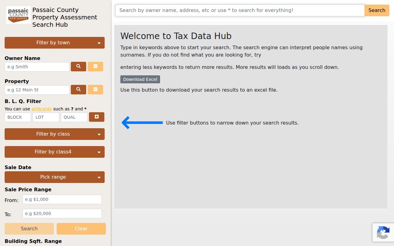
The assessment interface shown here is useful after the parcel is identified, because it exposes address, owner, and BLQ search routes without turning an assessment hit into residence proof.
Passaic Street Assessment Search
TaxDataHub is linked from the City of Passaic assessor page. Its inspection showed Owner Name and Property fields, a B.L.Q. filter, class filters, sale-date and sale-price ranges, building-square-footage and year-built ranges, plus result sorting and a download warning. The portal also states that block and lot entries have maximum lengths and shows `?` and `*` wildcard support in the BLQ search. Save the exact search type and displayed import date with a result.
An assessment result is a research lead. The portal’s owner name can be abbreviated, delayed, or associated with an entity. Sale or construction fields are assessment data, not a certified legal description. When the question involves a recorded transfer, move from the address and BLQ to the Clerk’s index rather than relying on the assessment page alone.
The City assessor quick-links route is the official path that points to the Passaic assessment search.
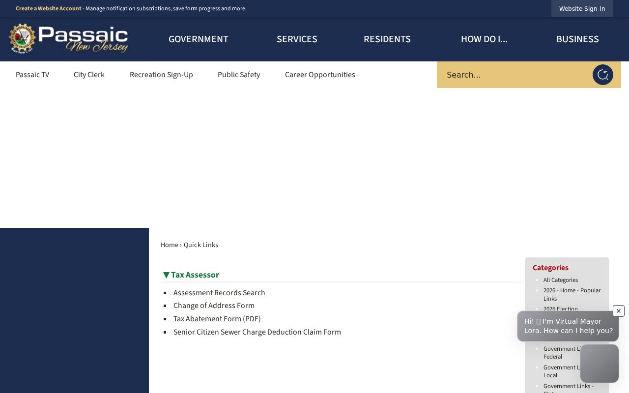
This City source supplies the official connection between Passaic’s assessor information and the contractor-hosted assessment search.
Passaic Street Records by Address
Address-keyed records offer different evidence. GIS draws the parcel. The assessor supplies property context. The Clerk index documents instruments, including deeds, mortgages, liens, easements, and releases. Historical directories can connect an address to a printed year. The City planning materials and targeted county requests can add municipal context when there is no online public index.
| Passaic street record | Keeper | What it can show | Access |
|---|---|---|---|
| Parcel and block layer | County GIS | Geometry and parcel fields | Official map service |
| Assessment search | City-linked portal | Property and assessment context | Online search |
| Recorded instruments | County Clerk | Document parties and dates | Online index |
| Directory street pages | PCHS | Dated street occupants | Holding or research route |
| GIS data request | County OPRA Center | Public layer or schema | Targeted request |
For current research, the property-to-instrument chain is the main Passaic street directory path. For a past household, switch to the directory year first. The Passaic city directory collections describe the historical shelf in depth.
Passaic Deed Trail by Street
The County Clerk’s online index covers records archived from December 1, 2000 to the present. Electronic deed and mortgage images begin January 1, 1989. The office describes older backfile conversion as ongoing and a digitization project reaching property records as far back as 1837, but neither statement guarantees an online image for every older instrument. Record the date range before deciding an address has no trail.
The Clerk exposes Document Type, Block/Lot, Name, and Instrument search modes. Document Type mode uses a document type and date range. Block/Lot uses municipality, block, lot, and dates. Name mode requires last name and can add first name, document type, and dates. Instrument mode uses an instrument number or book/page. Select Passaic City in the municipal menu when the question concerns the city.
- Parcel
- A mapped property unit, not a list of people.
- Situs address
- The property’s physical street address used to locate the parcel.
- Plat
- A mapped subdivision or land description used with a property record.
- Criss-cross directory
- A directory arranged to trace an address as well as a name.
Passaic Street History Sources
PCHS historical directories, local newspapers, and the Library of Congress Sanborn item give the street directory a time layer. A Sanborn map can show buildings, streets, industrial parcels, and neighborhood form, but it is not a household list. PCHS’s 1915 and 1922 street-page notes are especially useful because they identify known milestones in how street information was arranged.
The City’s historical-places material puts Main and Van Houten avenues in a 1915 streetcar-era context. That can explain an older label or a business district reference. It does not replace a directory year, a parcel field, or a recorded instrument. Preserve the historical source’s original address form next to the USPS-standardized form.
Note: A street name change, abbreviation, or old house number should be searched as a recorded variant, not silently corrected.
Passaic Street Request Limits
No official public citywide download of Passaic City address points was located in the inspected sources. County GIS says NJOGIS address points and other layers are available through its data offerings, with requests directed to the County OPRA Center. A focused request can ask for the current public layer, field schema, municipality, format, and publish date.
Likewise, no complete public municipal index for permits, code cases, cemetery plots, or occupancy certificates was located. A request should give the street range or parcel, record type, and narrow date range. Zoning and redevelopment documents can supply context but do not establish a person’s connection to a property.
Passaic Street Directory Boundaries
A street directory can show the record trail attached to an address. It cannot safely provide a private household roster. The GIS parcel layer is not an owner-name layer. An owner record is not proof of present occupancy. A deed grantee, lien party, or business address has a distinct legal role. USPS also warns that postal standardization does not verify a person or company at an address.
Address Confidentiality Program and Daniel’s Law protections can restrict public address disclosure. When a record is redacted or a request is denied, do not attempt to reconstruct the protected information from other sources.
Passaic Street Research Notes
Good notes make a Passaic street directory result repeatable. Keep the address as supplied and as standardized, the municipality, PAMS_PIN, block, lot, qualifier, layer title, and query date. For assessment work, note the search type, import date, and record count. For an instrument, record document type, recording date, party role, instrument number or book/page, and whether an image was available.
The County Clerk’s Property Fraud Warning System is a useful local reminder to verify a matching instrument through the official index. The free alert is informational, not a finding of fraud. If a result is unfamiliar, preserve the instrument number and use the Clerk’s documented office contact.
Passaic Street Name Context
Passaic’s historical record trail reflects dense urban streets, industrial growth, and shifting civic patterns. The City historical source describes Main and Van Houten avenues and streetcar connections to Newark and Paterson in 1915. That context can help when a directory, map, or newspaper uses an older local description. It does not settle a parcel boundary or identify a person without a matching source.
GIS uses current parcel geometry, while an older directory may preserve an earlier street form and a recorded document may use a legal description. Keep each original form and date in the file. That discipline makes it possible to explain why two accurate sources appear different rather than discarding one.
The municipality check is also essential. Passaic City is one of the county’s municipalities, and the Clerk search menu includes Passaic City alongside other county choices. A postal place name or a countywide record can therefore reach a different municipal context than the address in hand. Compare the GIS PCL_MUN value, assessment result, and recorder municipality setting before following a block-and-lot trail. This simple check prevents a similar street name or familiar surname from pulling a street-directory search into the wrong locality.
When the address is an apartment, a corner parcel, or an old street number, the parcel key may not mirror every part of the printed address. Preserve unit text separately from the block, lot, and qualifier. County GIS can locate the spatial parcel, while the City-linked assessment system and Clerk index provide their own date-bounded records. The differences are useful research notes, not errors to erase.